

Building data for analyses and the viewer comes in two kinds: PLATEAU 3D city models published by the government, and user data you upload yourself.
Add a PLATEAU city model
- Press + beside PLATEAUデータ (PLATEAU data) in the left panel.
- Search by prefecture, city or ward, or open a prefecture and pick. Filter by 建築物 (buildings) or 橋梁 (bridges).
- Press 追加 (Add) to load the model onto the map.
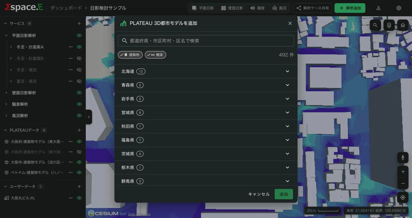
A loaded model can be coloured from its row's ⋯ → スタイル (Style) (Editing display styles) and removed with 削除 (Delete).
Upload your own data
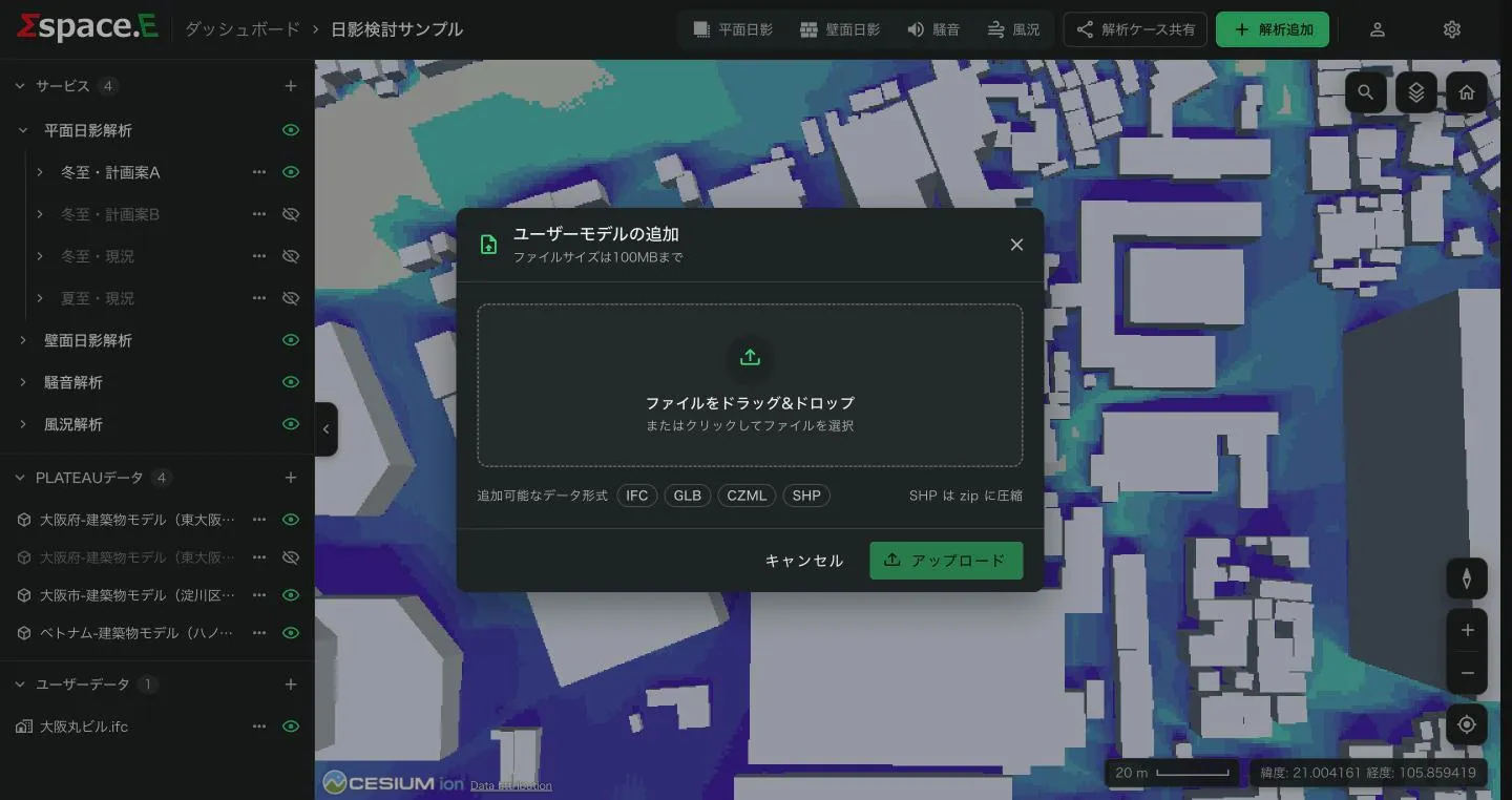
- Press + beside ユーザーデータ (user data) to open ユーザーモデルの追加 (Add user models).
- Drag a file onto the box, or click to choose one.
- For IFC and GLB, set the placement under 配置 (Placement) (table below). For SHP, choose a 表示色 (display colour).
- Press アップロード (Upload).
- Formats
- IFC · GLB · CZML · SHP (zip the SHP set)
- Size
- Up to 100 MB per file
- How many
- Depends on plan (Free 3, Basic 15, Business unlimited)
After upload, IFC and SHP are converted on the server for display: "Uploading", then "Converting… %". It can take a few minutes; keep the window open. A converting row shows its progress. If conversion fails, the row gets a red icon and "File conversion failed"; delete it from the row's ⋯ and upload again.
Placement when uploading (IFC, GLB)
| Item | Default | Meaning |
|---|---|---|
| Rotation (degrees) | 90 for IFC, 0 for GLB | Orientation of the model |
| Height | 0 m | Height above the height reference |
| Height reference | Clamp to ground | Clamp to ground, relative to ground, absolute |
| Set the base point latitude and longitude | Off (IFC) | Turn on to place it by longitude and latitude; off uses the coordinates in the IFC file |
| Longitude, latitude | — | Always entered for GLB |
Exporting IFC from Revit, Civil 3D or AutoCAD: step-by-step videos and PDFs are under "マニュアル・ドキュメント" (Manuals) on the product home page.
Moving a model
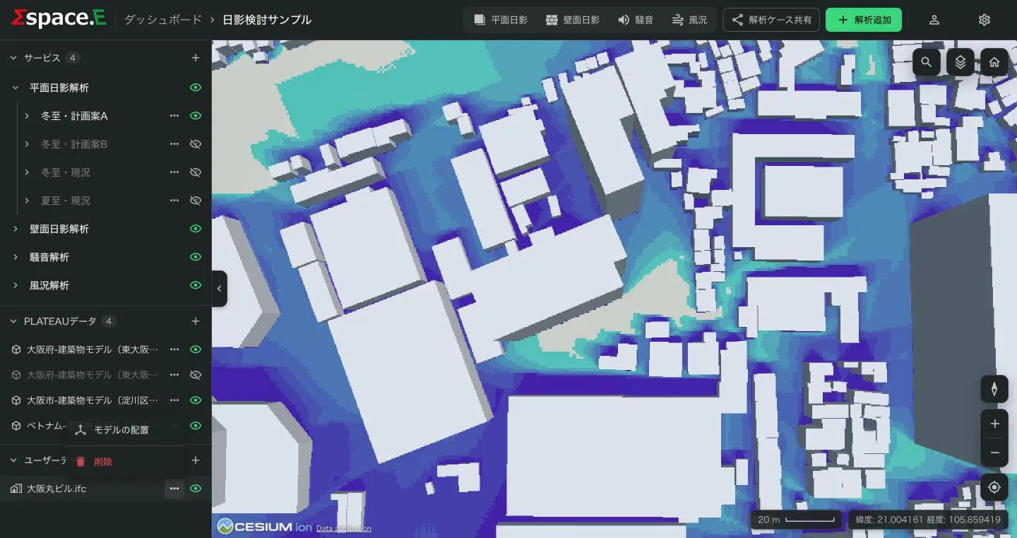
For IFC and GLB, the row's ⋯ → モデルの配置 (Model placement) adjusts the placement later, in a panel on the right.
- Drag the centre dot on the map to move it.
- Edit 経度 (longitude) and 緯度 (latitude) as numbers.
- 回転 (Rotation) is a 0–360° slider.
- With 高さの基準 (Height reference) set to relative to ground or absolute, 高さ (Height, 0–500 m) can be changed; it is ignored while clamped to ground.
Press 保存 (Save) to apply.
Deleting data
The row's ⋯ → 削除 asks you to confirm. Deleted data cannot be recovered.